Map Information:
|
Map Title: |
ClipRing - Wetlands and Residential Population |
|
Name(s) of Author(s): |
Dnyanada Bhide, Carlton Dudley, Frank Sorce |
|
Organization: |
NJDEP |
|
Email Address: |
Dnyanada.Bhide@dep.state.nj.us |
|
Software Used to Make Map: |
ArcGIS 10, Excel 2010 |
|
Data Sources: |
NJDEP, US Census, OGIS |
|
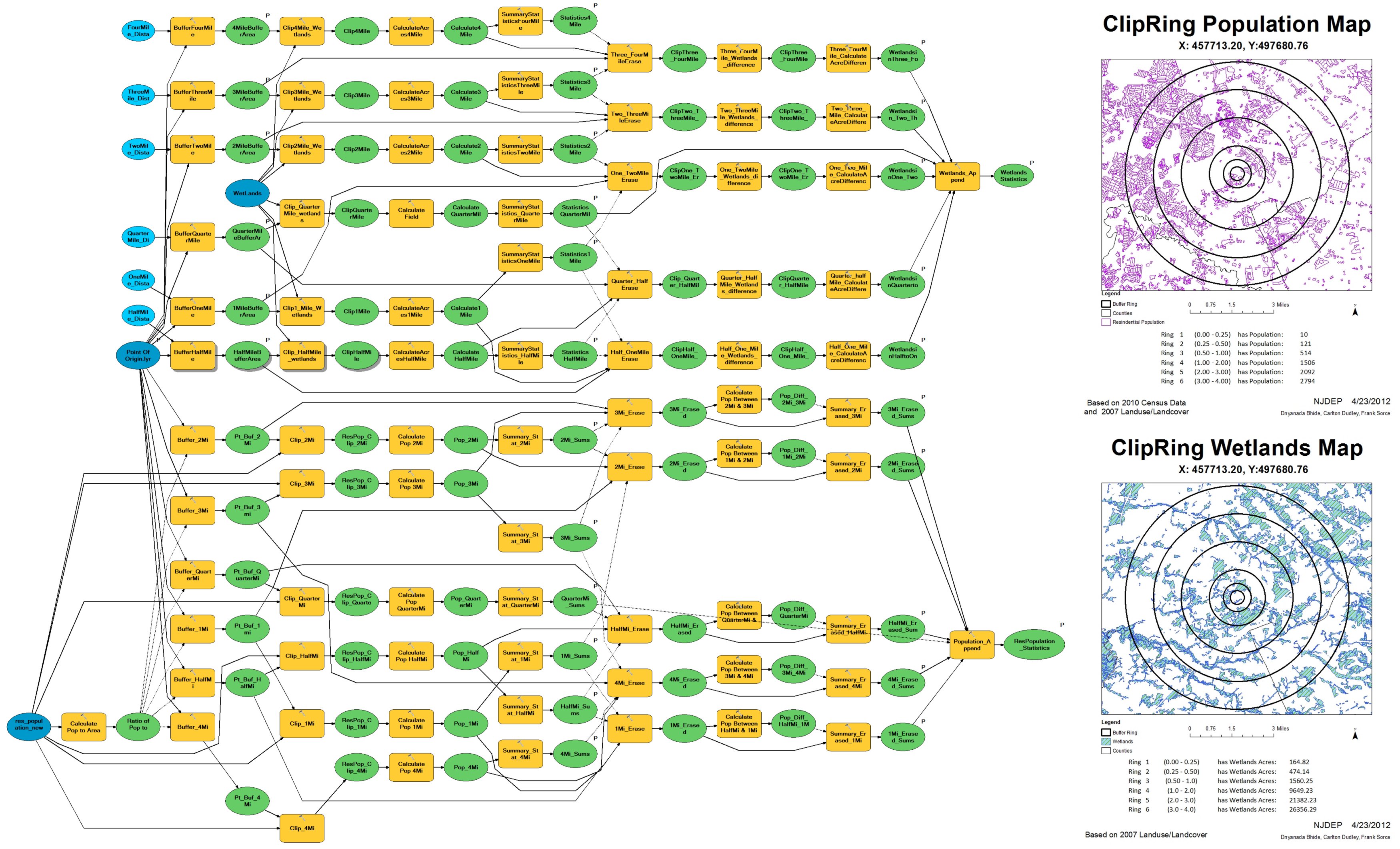
Map Description: |
These ClipRing maps are output of a model. This model was developed to help in the business process of Bureau of Environmental Measurement and Site Assessment. It accepts user clicked point of origin, then clips the LandUse2007 wetlands and Residential Population feature datasets to pre-specified buffer rings – Ľ mile, ˝ mile – to up to 4 miles. The residential Population feature dataset is derived from 2007 LandUse Residential polygons, overlaid with the Census Block 2010 layer. The model calculates the total area as well as total population that falls between each buffer ring and generates 2 maps and reports. DEP needs to send these reports to EPA. The information is used in the scoring of sites that EPA investigates for inclusion in Comprehensive Environments Response, Compensation and Liability Information System (CERCLIS) Database. |