Map Information:
|
Map Title: |
Parcel Management within the New Jersey Meadowlands |
|
Name(s) of Author(s): |
Adam Osborn |
|
Organization: |
New Jersey Meadowlands Commission |
|
Email Address: |
Adam.Osborn@njmeadowlands.gov |
|
Software Used to Make Map: |
ESRI ArcGIS 10 with ArcInfo License, Microsoft Publisher 2010 |
|
Data Sources: |
New Jersey Meadowlands Commission MERI-GIS, Municipal Tax Maps |
|
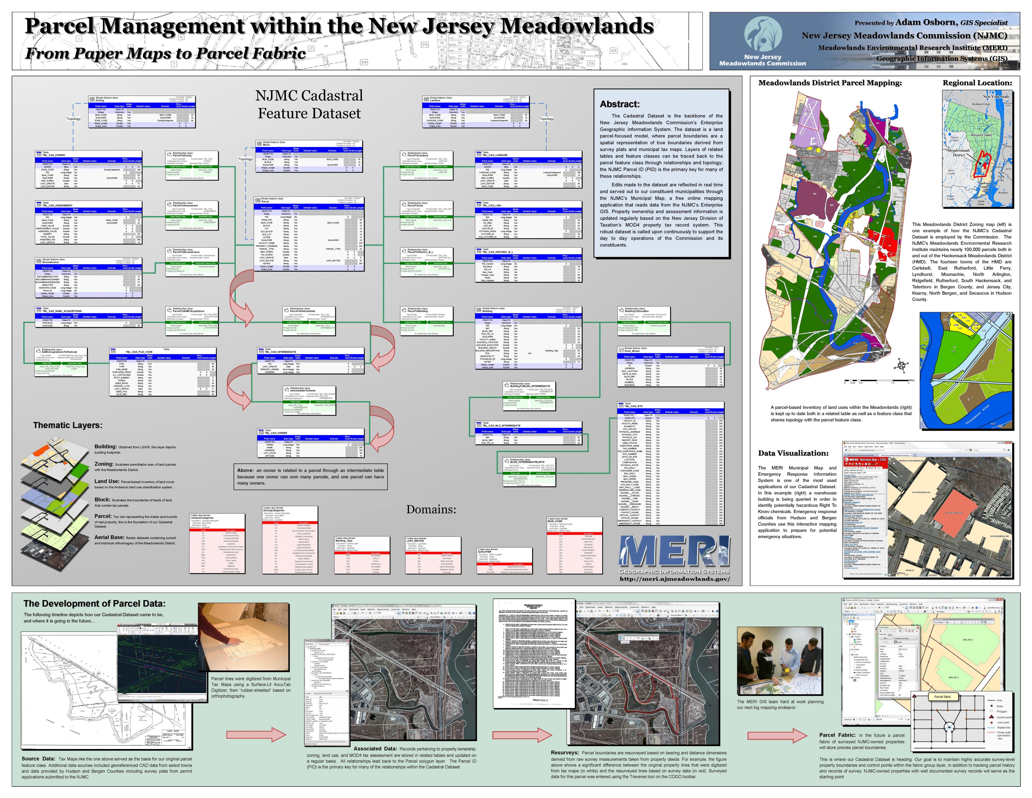
Map Description: |
This poster highlights the structure and lineage of the NJMC Cadastral Dataset, the backbone of the New Jersey Meadowlands Commission's Enterprise Geographic Information System. The dataset is a parcel-based model, where parcel boundaries are a spatial representation of property boundaries derived from survey plats and municipal tax maps. Layers of related tables and feature classes can be traced back to the parcel feature class through relationships and topology. This robust dataset is called upon continuously to support the day to day operations of the Commission and its constituents. |