Map Information:
|
Map Title: |
Category 1- Hurricane Irene vs. Category 1- Hurricane Sandy |
|
Name(s) of Author(s): |
Daniel Constanza |
|
Organization: |
Burlington County, Department of Information Technology, GIS Section |
|
Email Address: |
dconstanza@co.burlington.nj.us |
|
Software Used to Make Map: |
ArcMap10, ArcCatalog, Microsoft Excel, Adobe Acrobat |
|
Data Sources: |
NJ OIT, i.c.c. |
|
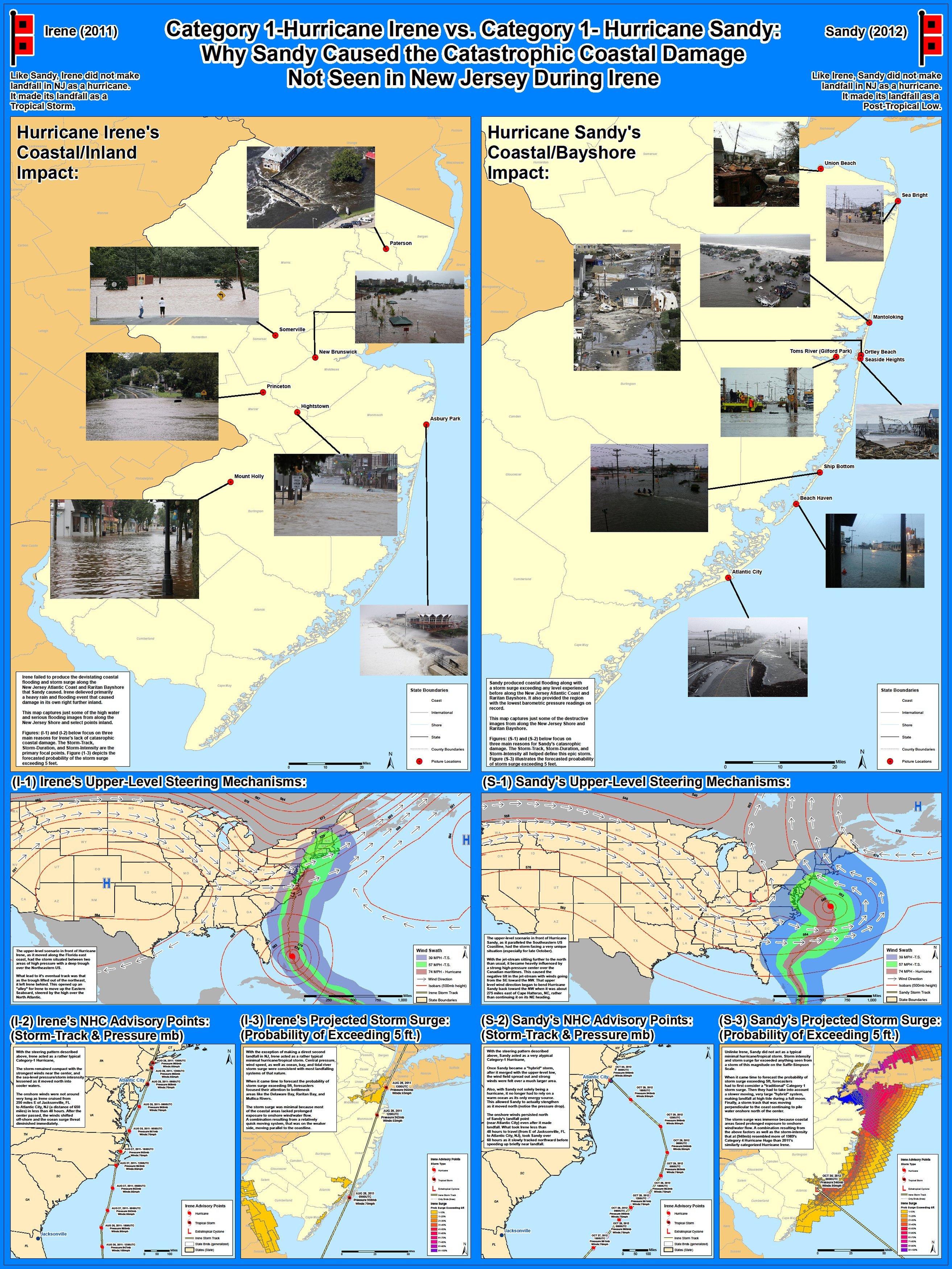
Map Description: |
Although neither officially made landfall in New Jersey as a hurricane, as they approached the state both Hurricane Irene (2011) and Hurricane Sandy (2012) were Category 1 storms on the Saffir-Simpson Scale. The coastal devastation caused by Sandy was an unprecedented event in NJ, while Irene was primarily a heavy inland rain/flooding event. This map emphasizes three main points on why Sandy caused the storm surge that decimated areas along the New Jersey Atlantic Coast and Raritan Bayshore: 1) Storm-Track, 2) Storm-Duration, and 3) Storm-Intensity. |