|
|||||||||

Studying River Herring - 2016 ReportBureau of Marine Fisheries January 31, 2017
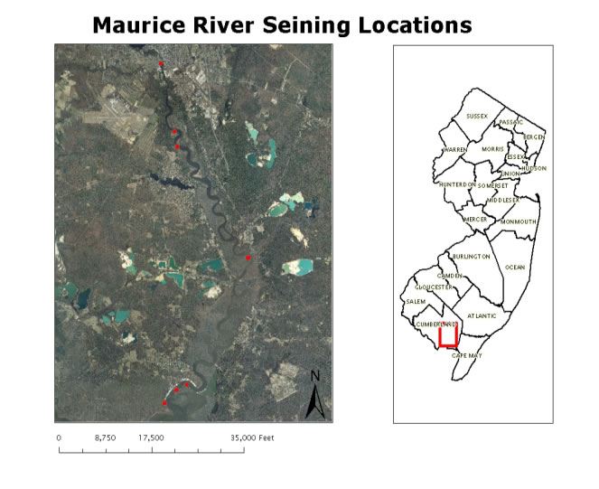
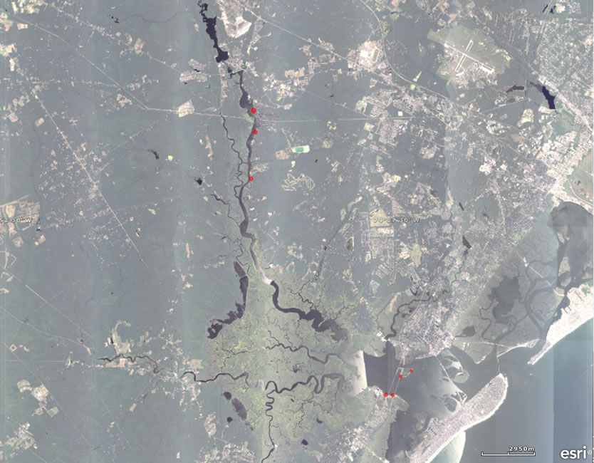
THE RIVER SYSTEMS The Rancocas Creek is a tributary of the Delaware River that has two branches that run through the Pinelands National Reserve. The main stem of the river is 8.3 miles long, the north branch is 28.3 miles long, and the south branch is 21.7 miles. Since 1975, spawning migrations of adult alewife and blueback herring have been confirmed in the main-stem as well as the north and south branches. The Maurice River is the second longest and largest tributary to Delaware Bay. It is 50 miles long and drains 386 square miles. Its mouth on Delaware Bay is surrounded by salt marshes and serves as a spawning and feeding grounds, nursery areas, and migratory routes for important recreational and commercial fish and invertebrates including alewife and blueback herring. Since 1977, the Division has confirmed spawning migrations of adult alewife and blueback herring below the Union Lake Dam. Union Lake is bounded by the 5,100-acre Union Lake Wildlife Management Area. The lake has a large variety of species including largemouth bass, gizzard shad, herring, and panfish. The Union Lake Dam is the first impoundment along the Maurice River. A Denil style fish ladder was installed in the spillway in 1991. The Great Egg Harbor River is one of the major rivers that traverse the Pinelands. It is 55 miles long and drains 308 square miles of wetlands into Great Egg Harbor and the Atlantic Ocean. It provides spawning and feeding grounds, nursery areas, and migratory routes for important recreational and commercial fish and invertebrates including alewife. Sampling stations were selected along the Maurice River and the Great Egg Harbor River in the shallow, near shore waters preferred by many developing juvenile and spawning adult fishes. Click on the links below for more River Herring Survey information:
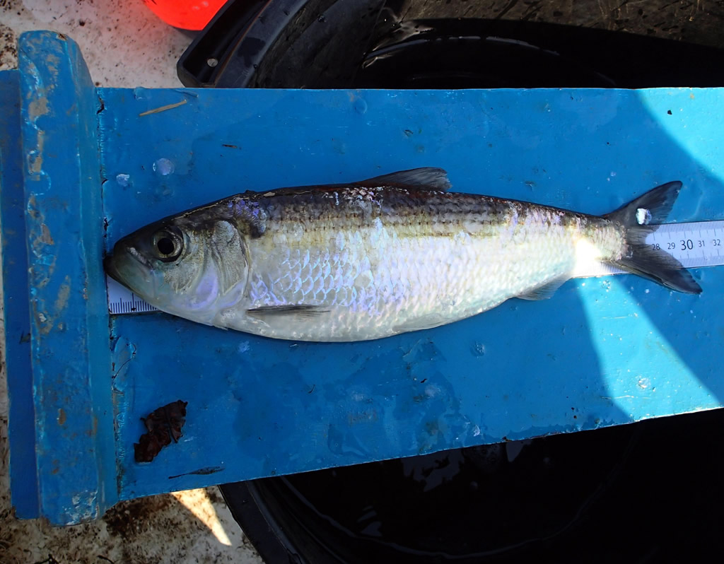
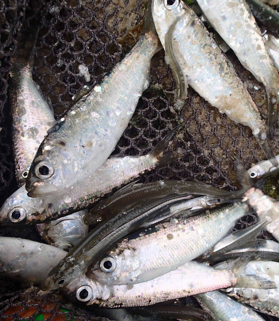
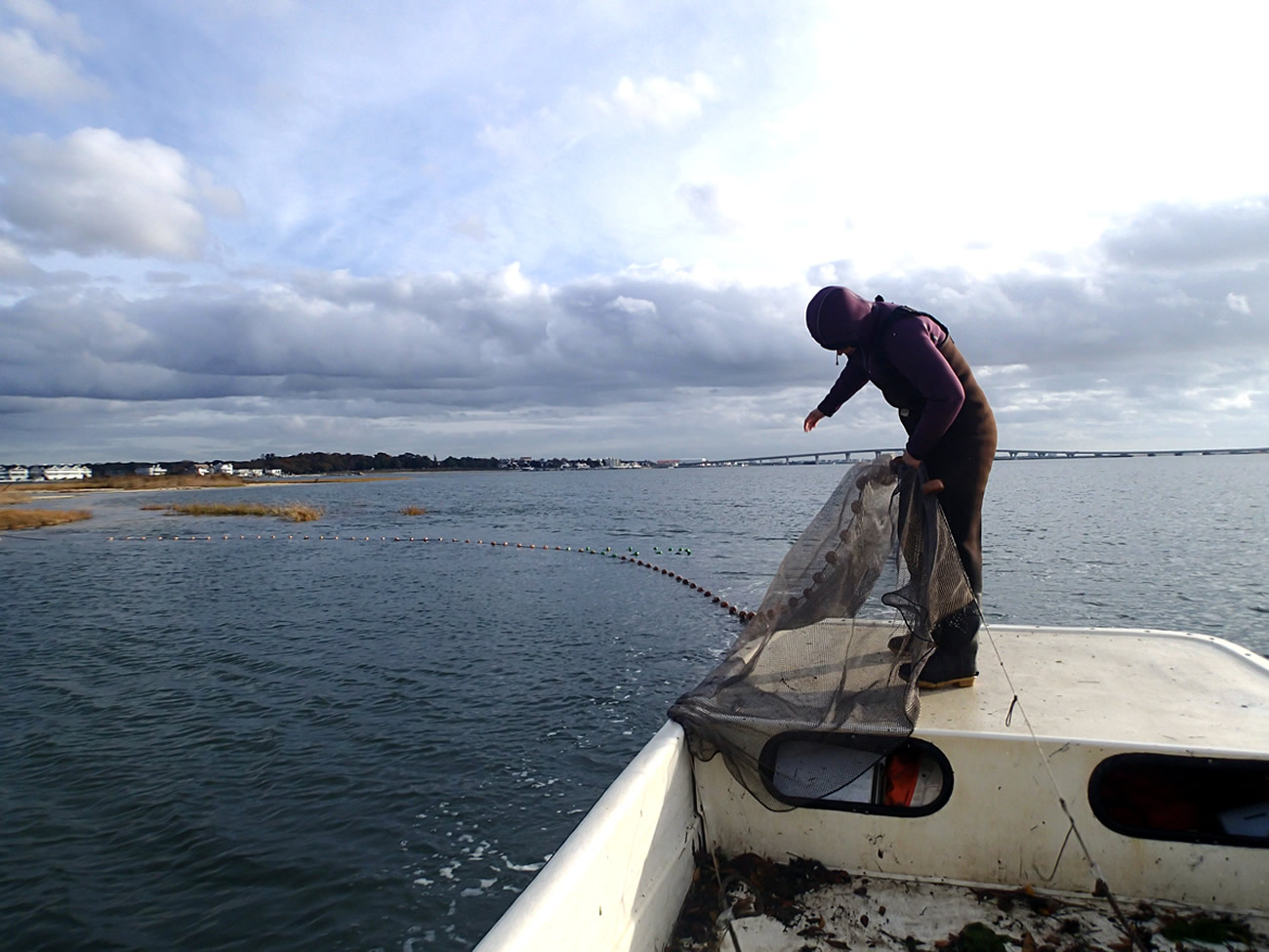
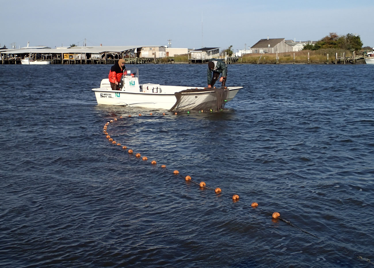
The gill netting process is the same for both the Great Egg Harbor and Maurice Rivers. A 20-foot Carolina Skiff is used to deploy two 129 ft. x 6 ft. x 3 in. mesh gill nets, with buoys used to suspend the net in the water column and anchors to keep it in place. The set time and other important data, including water quality and weather, are recorded and the net is left to soak for an hour and a half. All fish caught are identified, counted, and measured. Seining methods are the same for each station on both river systems. The same boat mentioned above is used to deploy a 100 ft. x 6 ft. x ¼ in. mesh beach seine net in a "U" along the shoreline. The net is pulled onto the beach keeping the lead lines on the sand in the water and the float line is held up funneling the catch into the bag of the net. All fish caught are identified, counted, and measured. Due to a limited number of seining locations, an electrofishing boat was utilized on the north and south branches of Rancocas Creek. Sampling via an 18-foot Smith and Root Model E electrofishing boat was performed for a one-hour interval and the start and end point is recorded with a handheld GPS unit.
WATER QUALITY INFORMATION
Water quality levels are recorded at each sampling site. The parameters recorded are salinity in parts per thousand (ppt), water temperature (°C), dissolved oxygen in milligrams per liter (mg/L), and pH. A probe is lowered to the bottom of the water column using a YSI brand dissolved oxygen meter. The meter gives instant readings which provide fast, accurate measurements.
Many factors such as weather events, tides, proximity to the ocean and freshwater inputs such as streams and rivers could influence salinity. Salinity values at a given location can vary from day to day due to these factors. On both river systems the salinity at stations varies; some are as low as 0.1 ppt and some as high as 31.4 ppt.
Species collected depends on salinity. Areas with low salinity see more freshwater species such as sunfish and largemouth bass while species such as bluefish, weakfish, and flounder are more common as salinity increases. Herring are found at stations with a lower salinity value.
Water temperature is an important water quality parameter that influences spawning seasons as well as egg and larval development and dissolved oxygen levels. Like salinity, it can be influenced by environmental factors including water depth, tides, and weather.
During gill netting season, staff have seen water temperature as low as 9.7 degrees Celsius, while during seining season, water temperatures have been as high as 28.7. Higher water temperatures bring tropical fish that are not normally seen in New Jersey waters such as gag grouper, mangrove snapper, and crevalle jacks. Data comparing water temperature and herring abundance show that water temperatures between 9.0 and 15.0 degrees Celsius seem to be ideal for spawning conditions for river herring.
Dissolved oxygen (DO) is a measure of the amount of gaseous oxygen that is dissolved in a body of water. For the River Herring Survey it is measured in milligrams per liter (mg/L). Oxygen diffuses into the water from the atmosphere at a rate that is influenced by tides, runoff, wind, temperature, and storms.
Adequate oxygen levels are essential to fish health at all life history stages with most species becoming severely stressed when levels dip below 2.0 mg/L. DO levels tend to have a significant impact on catch totals as fish will avoid areas of low DO and congregate in areas of higher DO. DO can vary from station to station and may be as low as 2.01 mg/L or as high as 10.1 mg/L. The average DO staff sees on the river herring study is 5.48 mg/L.
pH is the measure of how acidic or basic water is. The range is from 0-14, with 7 being neutral. pH less than 7 is acidic and greater than 7 is basic. pH determines the availability and solubility of nutrients and heavy metals and whether or not aquatic life can use it. Both river systems used for the river herring survey have a slightly basic pH with the average value being 7.6.
RESULTS
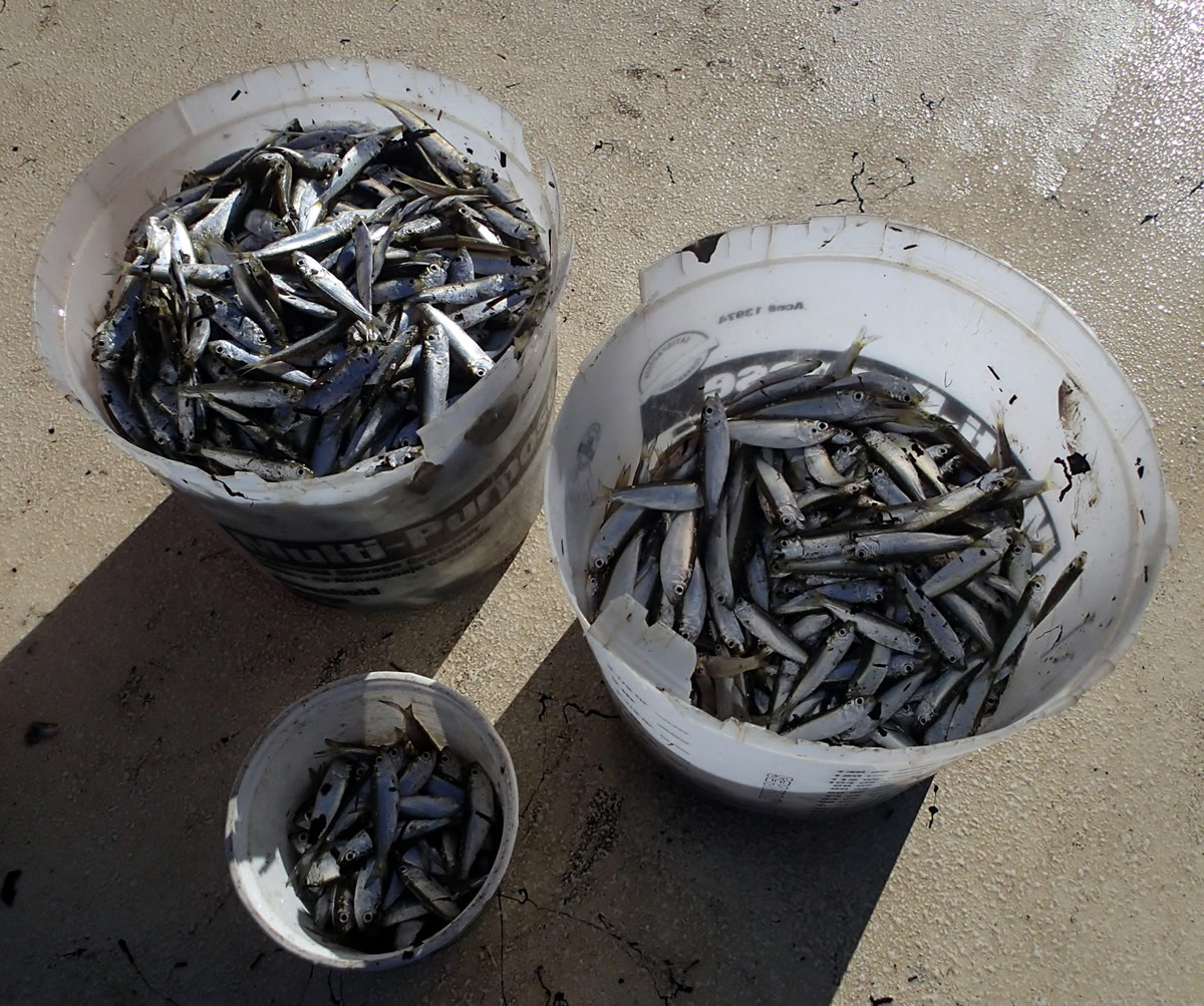
Through 2016, the Division has completed four years of the River Herring Survey. For the gill netting season, a total of 599 adult alewife and 12 adult blueback herring have been caught along with other species such as gizzard shad, white perch, white sucker, and chain pickerel. For the seining season a total of 3,848 juvenile alewife and 8,660 juvenile blueback herring have been caught along with other species such as bay anchovy, Atlantic silverside, weakfish, blue crab, and hogchokers. Percent frequencies and geometric means are calculated for both alewife and blueback herring.
For the gill netting season, the highest numbers seen in the alewife population occurred in 2016 with a total of 325, while the highest numbers for blueback occurred in 2014 with a total of 5. The highest numbers for the seining season occurred in 2014 for both alewife and blueback with totals of 2,351 alewife and 6,807 blueback herring.
Geometric Means for River Herring and Target Species (pdf, 52kb)
A geometric mean is the average of a set of products. This calculation provides the catch per unit effort which allows biologists to measure the abundance of a target species. When comparing geometric means from different years, changes in the values signify changes to the species true abundance.
2016 gill netting for both rivers produced the highest geometric means of river herring for the time series. For seining, the alewife index was below average in both rivers. The blueback herring index was below average for the Maurice River but slightly above for the Great Egg. More years of sampling will help provide a better estimate of population trends. New species not caught in previous years include a blue spotted cornetfish, cownose ray, remora, and banded drum.
On occasion some unique species were caught that are not typically seen in New Jersey's marine waters. These fish tend to show up in our area in late August through September when water temperatures are often at their highest and are often native of the waters of the southeast coast. Some unique migrants caught over the past few years include crevalle jack, gag grouper, mangrove snapper, spotfin mojarra, and ladyfish.
For more information about individual species (biology, range, etc), please visit one of the following websites:
Data collected from this survey is used by biologists to develop relative abundance indices and length frequency estimates of adult and juvenile river herring. These are important tools used by fisheries biologists to predict future stock trends and harvest potential of river herring.
Surveys like the River Herring Survey are the groundwork for the overall stock assessment process. Data gained from such fisheries surveys can be used at a state level to assess local fish stocks or combined with data from other states to better understand coast wide population trends and harvest potential.
Over the past 20 years, river herring populations have declined by 90%. The River Herring Survey was designed to enhance current understanding of overall stock levels and to gain information specific tot the NJ populations. Data collected from the River Herring Survey have shown an increase in both the alewife and blueback herring populations in both the Maurice and Great Egg Harbor Rivers.
The ultimate goal is to expand sampling to all Delaware River tributaries and Atlantic Coast rivers to obtain adequate data to develop a sustainability plan and restoration targets for alewife and blueback herring.
|
||||||||||||||||

|
||
|
|
||
|
||
| |
||